fowey
river journey
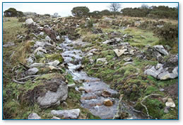 |
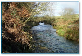
 Water running off moor
The Fowey River catchment is one of the largest river basins
in South Cornwall. The catchment drains an area of about
177 km2 of central and southern Bodmin Moor. The main tributaries
of the Fowey that drain this area are Cardinham Water, the
St Neot and the Warleggan River.
|
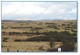
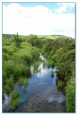
High Moor 
From Bodmin Moor, with its high rainfall
and many fast flowing streams, the Fowey runs through narrow
wooded valleys to a ria (drowned valley) then broadens into
a wide estuary.
|
 |
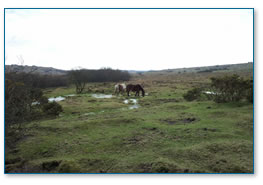 |
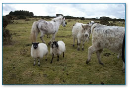
Horses on moor
Bodmin Moor compared to
other upland areas in the country is quite low. It reaches
450m above sea level at the summits of Brown Willy and Roughtor. |
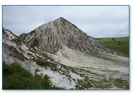
Eroding Sky Tip
There are extensive remains
of disused china clay (kaolin) pits in the upper Fowey catchment,
with flooded pits, sky tips and derelict buildings.
|
 |
 |
Hawks Tor pit
Hawks Tor pit is a disused china clay pit that was worked
from 1895 -1950. The flooded pit has been successfully used
for rearing young salmon (fry) |
Animals grazing on the moor
Bodmin Moor is largely common land and
many farmers graze their animals on the moor- sheep, horses
and cattle. This is what gives the moor its character but
it can lead to overgrazing which leaves the moor bare of
grass and other plants.
|
 |
 |
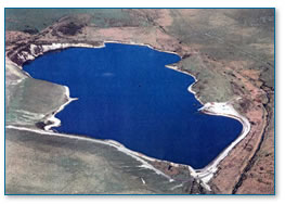
Colliford
The whole of the Fowey
catchment area is set at the highest water quality grading
of River Ecosystem. The catchment can contribute up to 65%
of Cornwall’s public water supply. Water is stored in
two reservoirs, the Siblyback Reservoir and Colliford Reservoir.
|
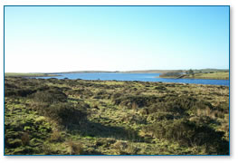
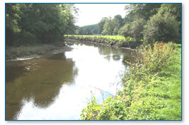
Draynes Valley below A30 (Palmersbridge)
As the Fowey drops down off the moor it flows
past Codda and under the A30 road at Palmersbridge, then down
Draynes Valley towards Golitha Falls. The whole of the river
in Draynes Valley is a fish spawning sanctuary for Sea Trout
and Salmon. |
 |
 |
Draynes Valley looking downstream from bridge
Part of this area of the catchment is listed as an Area of
Outstanding Natural Beauty (AONB) and there are several places
designated as areas of Special Scientific Interest (SSSi’s)
because of the rare flora and fauna to be found there. |
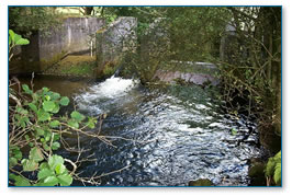
Treskeivesteps
The Fowey is used as
a passage to transfer water from Syblyback Reservoir to
Trekeivesteps, and Colliford to Restormel, where it is abstracted.
|
 |
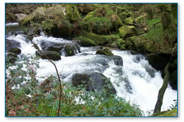 |
Golitha Falls
At Golitha Falls National
Nature Reserve (NNR) the Fowey leaves the granite of the moor
and passes through a steep gradient. The river then flows
at a slower pace over Devonian slate and the land use changes.
|
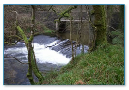
Doublebois Bridge
Two Watersfoot, by Trago
Mills, is where the St Neot River meets the Fowey, to be
joined a few miles later by the River Warleggan.
|
 |
 |
Lanhydrock house
The river is much bigger
now and curves gently southwards past Bodmin Park Station
and Lanhydrock House. |
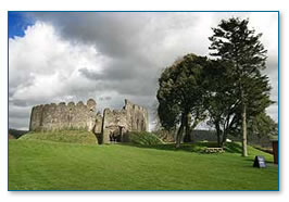
Restormel Castle
Restormel Castle overlooks the River Fowey
|
|
|
Tudor Bridge on the Fowey
As the river approaches
Lostwithiel it becomes intertidal. Lostwithiel is about 35km
away from where the Fowey rises on Bodmin Moor. |
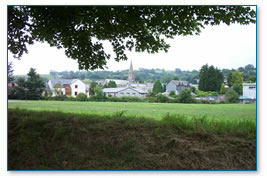
Lostwithiel from river
Lostwithiel is small
stannary (tin mining) town. It is an ancient commercial
market and was first settled in Roman times. Lostwithiel
was recorded in the Doomsday Book and in the 13th and 14th
centuries it was the capital of Cornwall and its most important
port.
|
|
|
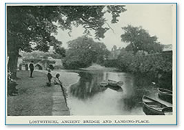
Old Lostwithiel
A photograph circa 1915
of the river Fowey below Lostwithiel’s ancient bridge.
The basin and landing place has changed little except that
more small boats used to pass to and fro between Lostwithiel
and Fowey in those days. The river was still used for commercial
transport until the 1930’s. |
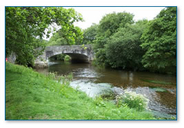
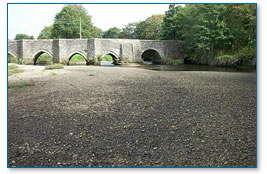
Mediaeval Bridge
The Mediaeval Bridge
at Lostwithiel is the upstream limit for navigation. Large
deposits of gravel are present below the bridge due to erosion
processes much higher up in the catchment.
|
|
 |
Coulson’s Park
The river enters Coulson’s
Park downstream of the Railway Bridge, a popular area for
recreational walking and angling. Peal Pool at the lower end
of the Park is one of the best holding pools for Salmon and
Sea Trout on the tidal Fowey. |
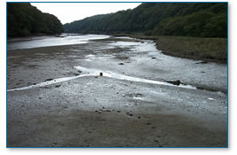
Shirehall Moor saltmarsh
At the lower end of Shirehall
Moor, salt marsh, saltpans, creeks and intertidal mudflats
dominate the scene. A real mix of fish species can be found
with Salmon, Sea Trout, Bass, Flounder and Mullet being
present at certain stages of the tide.
|
|
 |
Fowey from Polruan
The river broadens as it
is joined by the River Lerryn and further down Penpoll Creek
and Pont Pill creek. At the mouth of the river as it opens
to the sea is the town of Fowey. |
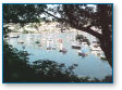
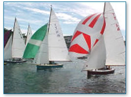
Sailing regatta
Fowey has a deep water
port and is a famous sailing and holiday resort. A ferry
crosses the river from Fowey to Polruan on the other side
of the estuary and ships sail in and out of the famous harbour.
|
|
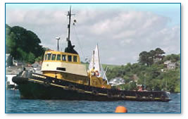 |
Tug boat in the Fowey harbour |
click
here
to view a map of the fowey catchment area |
|
|
|
|