seaton
 The
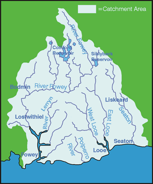
Seaton is a small lively river, stemming from Bodmin Moor at a height
of 370m and flowing in the direction of Hessenford, before entering
the sea at Seaton. The
Seaton is a small lively river, stemming from Bodmin Moor at a height
of 370m and flowing in the direction of Hessenford, before entering
the sea at Seaton.
The total length of the
river is approximately 17km. The underlying geology of the catchment
is predominantly made up of slates and shale which tend to shed
water rather than infiltrate it.
Heavy rain leads to rapidly
increasing flow rates which are then dissipated by the floodplain
in the lower reaches.
The river valley is narrow and
steep with the main channel in the lower reaches having undergone
extensive channelisation, leading to the river becoming unnaturally
straight and deep.
Below Hessenford, the riverwidens
and a distinct floodplain has developed up to 100m wide.
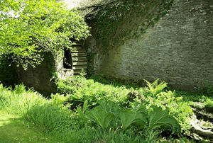 |
Waterwheel on a leat off the main river
|
The Seaton valley contains several
wetland features such as spring fed wet floodplain woodlands which
are rare habitats within the UK. Elsewhere, the catchment is characterised
by low grade agriculture and forestry.
|