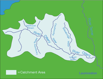
ottery
With a length of 33km, the river
Ottery drains an area of 124.5km2 and forms one of the main sub-catchments
of the Tamar system. Due to heavy impermeable clay soils and low
permeability and porosity within the underlying geology (mostly
shale), groundwater storage within the catchment is limited and
flood risk is high, particularly around Caudworthy Water and Bolgate.
Historically, mining in the Ottery and Canworthy headwaters has
lead to an increase in mineral levels in the river, accentuated
by rapid run-off from the land. Excess mineral loadings have led
to fish kills in the past, the most recent event taking place in
the Autumn of 1995.
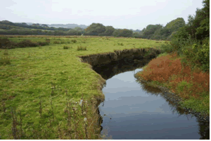 |
| River
Ottery just upstream of Canworthy Water |
Most of the area consists of
large specialist dairy farms (especially in the upper reaches) although
cattle and sheep can be found at the downstream end. The main arable
crop is maize in addition to a little cereal growing. There are
five SSSI's in the Ottery catchment including the Ottery Valley
SSSI in the headwaters which consists of 33ha of rapidly diminishing
culm habitat. The catchment also hosts 5 CNCs, 1 Special Historic
Landscape site and a proposed Area of Great Landscape Value (AGLV).
The
Ottery supports a broad range of wildlife including populations
of trout and migratory fish, otters, kingfishers, sand martins,
dippers, curlews, snipe and the marsh fritillary.
|